
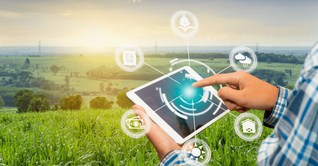
Agriculture has undergone a massive transformation with the help of GPS tracking systems. Gone are the days of manual labor, mechanized irrigation, and guesswork in crop management.
Agribusiness owners enjoy increased productivity and improved farm planning with an advanced global positioning system (GPS).
With a consistent increase in the consumer base and their instant need for culinary gratification, it was high time the agriculture sector received quality optimization that helped farmers keep pace with year-round demand.
They needed something to empower them to combat natural unpredictability, land scarcity, and economic imbalance.
Modernization has encroached on every sector of human life. The agriculture industry finally took a massive leap by replacing draft horses with tractors as potential harvest equipment and mechanizing its task force.
As a result, GPS replaced the naked human eye and experienced the assumptions of a farmer. Instead, it introduced precision farming, soil sampling, tractor guidance, yield mapping, and navigating farm areas.
John Boelts, Vice President of the Yuma County Farm Bureau, comments, ‘We started using more digital technology in the last 10 years. We have gone to GPS (Global Positioning System) for a handful of different operations from cultivating to planting. By using GPS on the tractors, the entire process, from leveling the field to planting the seed to irrigating the crop has been much more efficient than in the past. GPS is used in a lot of applications throughout most aspects of agriculture.’
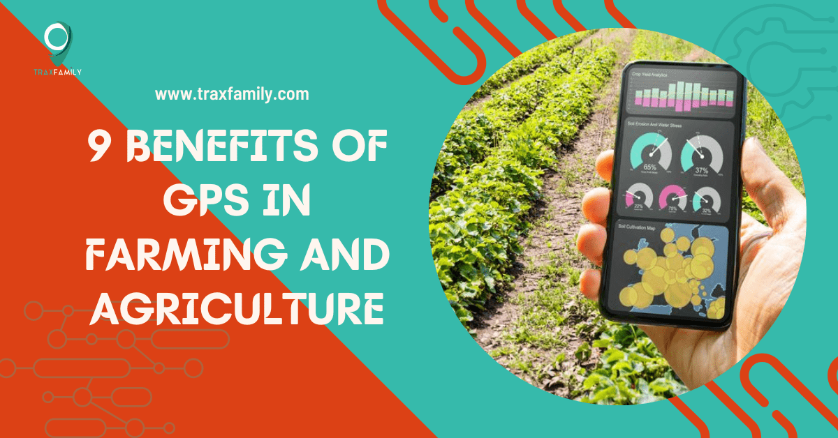
9 Benefits of GPS in Farming and Agriculture
Among the multiple benefits of GPS in the farming industry, here are a few advantages that increase the productivity of farmers and make agriculture a cost-effective sector:
1. Geofence Farm Fields
A geofence is a virtual perimeter that marks the extent of a real-life geographical area. It works in association with GPS and triggers a response whenever the device crosses the boundary of your virtual field.
Technologically advanced farmers use geofences to maintain order within their farmlands. For instance, the farm owner receives a signal if farm equipment leaves the area. Likewise, it alerts the owner about any specific restricted farmland area.
Geofence readings have further enabled farmers to identify warning signs of soil cultivation. That way, they could avoid future crop failures.
In addition, geofences help farmers to identify areas that require fertilizing or harvesting. Using geofencing, you can spot the areas that suffered damage from pesticides or the ones which are best for organic growth.
In the case of livestock, the farmers use a geofence to monitor the respiratory rate, heart rate, or digestion rate of their cattle. The device notifies the farmers if any animal strays from the herd or gets lost on its way back.
2. Track Farm Equipment & On-site Farmers
Record keeping and maintaining expensive farm vehicles and equipment can be challenging in the agriculture industry. With GPS tracking devices, a farmer can easily monitor and locate farm tools and vehicles used to cultivate a vast expanse of land.
The fleet management solutions empower GPS to identify the position of agriculture equipment, thus making it easier to secure them during emergencies.
Suppose you’ve received warnings about a tornado that will pass through your land. A glance at the GPS reading will highlight if any farm assets are missing or in harm’s way. That way, you can secure them sooner.
To add, use GPS to track your farm workers while at work. Constant visibility of your employees enhances communication and helps in decision-making. Also, it means that less supervision is required, ensuring you need less seasonal labor.
3. Maintain Farm Equipment
One of the impactful benefits of GPS in agriculture is its potential to enhance the life span of farm equipment. Farmers are now exploiting this proactive feature of GPS to manage and monitor farm tools and vehicles regularly.
Further on, the digital positioning system uses engine hour tracking and produces a diagnostic report. This status analysis of your farm equipment can help spot a potential problem. The sooner you repair them, the better it is.
Also, GPS tracking can help farmers get a higher value for a piece of equipment at the time of resale. GPS data can demonstrate the machine’s functionality and provide supporting documents about its well-maintained condition.
4. Prevent Farm Theft
Many local gangs in rural towns often exploit a farmland’s isolated location. Over the years, rural criminal records have shown that frequent theft of lambs has transformed into an organized robbery of tractors that cost a fortune.
Above all, Transpoco Telematics has rightly pointed out that technical advancements in cars have prevented robbers from stealing them. Thus, farmers and their vehicles are an easy target for delinquents.
The perpetrators take these stolen goods to countries like Romania and Germany, where they can sell the batteries and motors on the black market.
Data from the National Crime Information Centre says there were over 10,000 reports regarding stolen goods from farmlands and construction sites in 2016. Protect your farm assets from thieves using GPS tracking devices.
GPS and geofencing watch over your agricultural materials, vehicles, and tools. They consistently inform you of the tools’ locations and operations. What’s best, the device notifies the operator when any object is misplaced, stolen, or ruined.
In such cases, recovery becomes easier because authorities follow a GPS tracking system to find them.
5. Precision In Soil Sampling
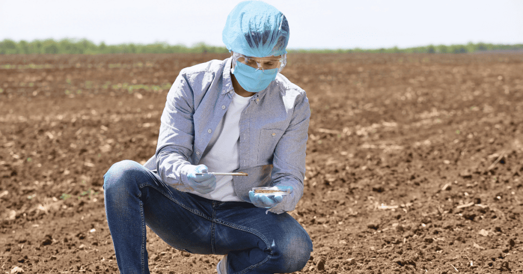
In the agriculture sector, soil sampling is a process by which scientists or analysts collect a small volume of soil to study its composition and determine its nutrient content.
The lab report will provide a farmer with clear information about characteristics that may affect plant health, like the soil’s pH level, acidity, and contaminants.
GPS soil sampling refers to the practice of scrutinizing soil from specific regions. Using GPS, a farmer can easily navigate and find a potential sampling ground. Out of three types of GPS soil sampling, grid soil sampling is the most common form of sampling soil.
According to seasoned cultivators, GPS soil sampling plays a pivotal role in crop planning stages. Once the process is understood, a farmer can choose the sampling method which supports their fertilizing technique. This scientific knowledge will enable a cultivator to take the right approach to crop management throughout the season.
Furthermore, GPS soil sampling allows a cultivator to reflect on their previous crop’s positive and negative aspects. This information will help them plan better farming steps, save time, and reduce futile agricultural expenditures.
6. Draws Farm Map
Farm mapping is an integral part of precise agriculture. It’s a practice where farmers create a detailed layout of their property, including boundaries, buildings, gateways, and water resources. They incorporate the crop details, like the areas where they planted different crops and the operations they performed.
Combining Geographic Information Systems (GIS) and GPS enables farmers to map and organize field information more categorically. What’s more, robotics and drones increase farm automation.
With the assistance of GPS, laying out a farm map with minute details has become easy. The tracking receiver collects location information and utilizes them to design a map that includes uncultivated areas containing weeds and diseases.
Its accuracy, therefore, enables farmers to be aware of precise acreage fit for farming, irrigation systems, roadways, and distance measurements between two agriculture location points.
7. Monitor Yield Data
Yield monitoring is another technology-induced data-collecting practice that allows farmers to gather information concerning the vast acreage and crop health and also helps develop a crop management system according to the sites. Remember, the yield monitoring procedure explains spatial and temporal differences in crop production.
Ultimately, the monitoring strategy produces a farm map influencing a cultivator’s decision-making process. For qualitative readings, a farmer must calibrate and install the sensors often used in collecting yield data with the harvesters. It becomes active during the harvest season.
Among the four major yield monitoring components, the GPS receiver plays a pivotal role in agribusinesses. The sensory receiver maintains a record of geo-referenced data that the farmers can interpret and represent on their map.
The operator assembles the field monitor inside the combined device. It delivers productive inferences to the farmer about the field and harvest. The real-time readings allow them to take fast measures in case of technical disruptions.
Note that these devices allow the user to access its integrated database and transfer the data to a personal computer. Accordingly, farmers use various software to interpret these readings.
8. Track Livestock
Livestock farming is crucial for a company’s economy. Tens of millions of people depend on cattle farming. They raise domestic animals to procure vital products and services, like food, fiber, and natural items.
Over the years, cattle theft has become rampant, resulting in massive losses among agriculture-based businesses. Almost 79.7% of cattle theft cases go unrecorded. Protect your livestock from thieves using livestock tracking devices like GPS.
It allows you to follow your cattle and track them down in real-time if they stray from their herd. This is possible to monitor through the tiny GPS tags your animals carry.
The combination of GPS with geofencing enables the user to carry out various functions like recording vaccination information, hormonal balance, weight loss or gain, and can create a medication routine. Above this, using GPS, the farmer can visualize and calculate the ideal performance rate of an individual animal or in herds for better productivity.
The Cattle Working Group of the National Animal Identification System has been inclining towards utilizing radio frequency identification (or RFID) as ear tags to determine battles. The association believes innovations such as this can solve livestock-oriented problems.
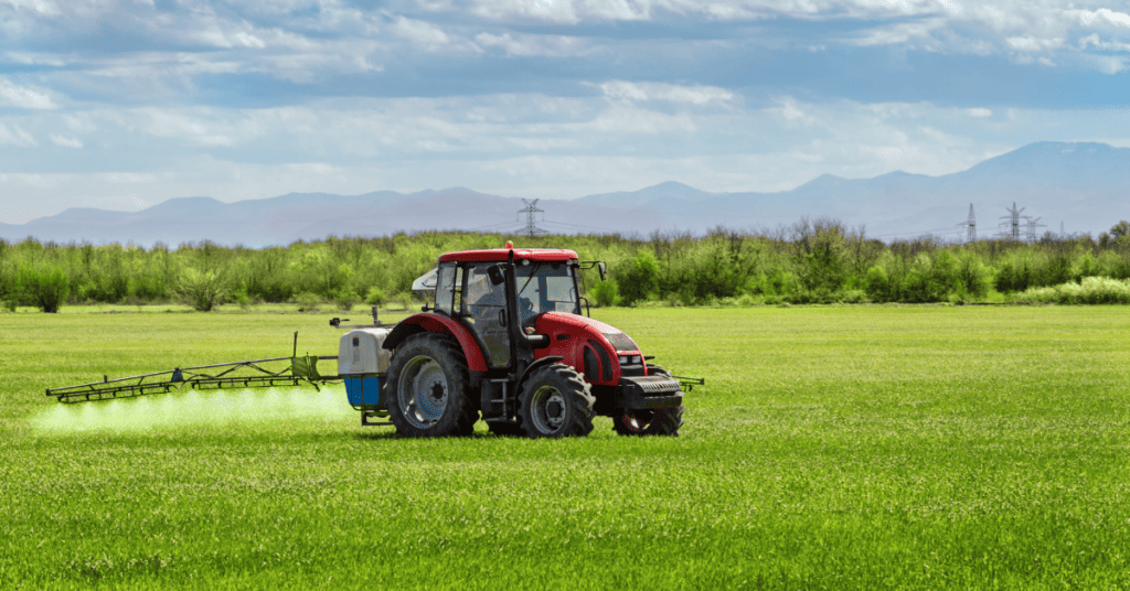
9. Influences Irrigation Systems
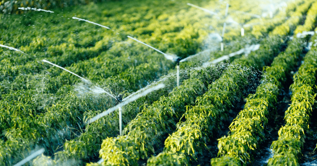
Among the numerous benefits of GPS in agriculture, an optimized irrigation system is one of them. For over 30 years, this technology has guided cultivators from planting seeds to directing farm machinery to maintain a precise row-to-row and swath-to-swath width. Amidst all, GPS has also been handling the irrigation process, which boosts better crop yield.
The major challenge of mechanized irrigation was to water the ends of long rows. GPS manipulates mechanized irrigation to spray water where it requires without wasting water on weeds or fallow ground.
It became possible with the sensory receiver collecting data and feeding them to the operator. The collected information enables the operator to decide where to install the sprinkler. A new problem that cropped up was that the watering guns could shoot water 50 feet from where it was intended.
To deal with this hindrance, farmers created an underground guiding system to control the watering arms. However, with the advent of GPS, navigating through furrows became obsolete.
Now, every irrigating sprinkler has an in-built GPS receiver. It tells the irrigating rig how much water to release and with what speed so that every part of the field receives it. That way, the farmer can utilize only as much water as required to nourish the crops and maintain their health.
Conclusion
The United States Department of Agriculture states, ‘…even as the amount of land and labor used in farming declined, total farm output more than doubled between 1948 and 2015’. This statement justifies the positive attributes of GPS-based applications in farming.
Today, farmers need tracking systems to keep pace with various factors like sustainability and time crunch. Therefore, the growing benefits of GPS in agriculture and the relevance of precision farming have helped the industry strike an equilibrium between supply and demand and various environmental factors.
Leveraging real-time data and inferences from GPS trackers enable farm owners to take time-sensitive approaches during field mapping and crucial planning. They can come to such conclusions because of the accurate and insightful observations sent by the GPS-like applications.
After more than 50 years, farmers continue to include GPS to improve farm-based activities. From allowing them to work under low-visibility farming conditions to regulate the usage of pesticides and fertilizers, agribusiness owners can handle it all without difficulty.

Stefan Quartemont is an experienced author and expert on GPS technology, with a particular interest in its practical applications. He gained his knowledge of GPS tracking during his studies at Texas A&M University and has since become a regular contributor to TraxFamily.com, providing valuable insights into the latest developments in GPS tracking. Stefan’s expertise and passion for leadership make him a respected authority on GPS technology, and his work with TraxFamily.com is highly beneficial to anyone interested in staying up-to-date on this exciting technology.